Property owners in Colorado’s Front Range and mountain communities need to become erosion detectives. Those small channels cutting across your slope aren’t random scratches in the dirt – they’re warning signals written in the language of flowing water.
Learning to read these patterns can mean the difference between a $2,000 preventive fix and a $20,000 emergency rebuild.
Understanding what your land is telling you starts with recognizing the three distinct stages of water erosion and knowing how to measure what you’re seeing.
The Three Stages of Mountain Property Erosion
Water erosion progresses through predictable stages, each more destructive than the last. The key to cost control lies in catching problems during the earliest stage possible.
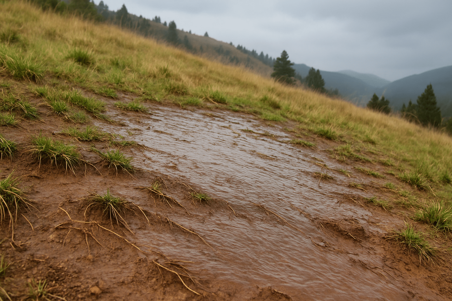
Sheet Erosion: The Threat

Sheet erosion happens when water flows across the surface as a thin, uniform layer, removing soil particles evenly. This stage is often invisible until substantial damage has occurred. On mountain properties, sheet erosion typically develops on slopes steeper than 15% where vegetation coverage is sparse.
Look for these signs:
- Uniform soil loss creating a slightly concave slope profile
- Exposed tree roots where soil once covered them
- Gradual “polished” appearance to the ground surface
The soil loss appears minimal (usually just a few millimeters per year) but in most cases, it can subtly affect large areas.
Rill Erosion: The Warning

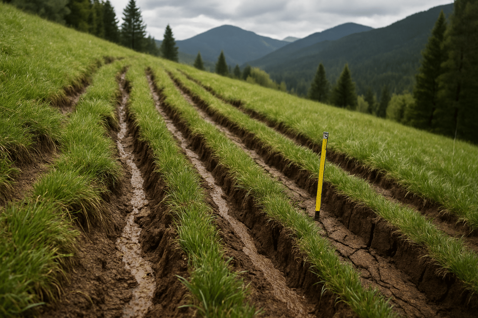
Rill erosion creates small channels typically 2-8 inches wide and 1-4 inches deep. These channels form when sheet flow concentrates into defined pathways. Rills can be eliminated with normal grading, which makes this stage the optimal time for intervention.
Rill spacing patterns tell you everything about future damage potential. Rills spaced 20-50 feet apart indicate moderate erosion pressure. When spacing tightens to 10-20 feet, you’re looking at high erosion potential that will accelerate rapidly without intervention.
Gully Erosion: The Point of No Return

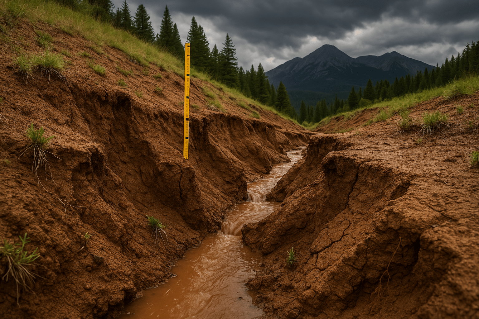
Gullies are channels too large and deep to cross with normal farm equipment – typically over 12 inches deep and 18 inches wide. Once gullies form, you’re dealing with engineering-level problems requiring heavy equipment, structural solutions, and significant expense.
Gullies grow through headward erosion, meaning they cut backward up the slope toward the source of water flow. A gully that starts near your driveway can work its way back toward your foundation over time.
How To Measure What You See
Property owners can conduct meaningful erosion assessments using basic tools and systematic observation. The key measurements that predict future damage are channel depth, spacing, and slope gradient.
Basic Measurement Technique
Use these measurement tools and techniques:
- Tape measure and ruler to document rill dimensions
- Measure depth at the deepest point, width at the top, and spacing between parallel rills
- Record measurements with photos that include the measuring tools for scale
- Document slope gradient using a smartphone app with inclinometer function or a simple A-frame level
Slopes over 20% (roughly 11 degrees) accelerate all erosion processes significantly.
Calculating Soil Movement Volumes
For property owners willing to do some math, you can estimate soil loss using rill measurements. A rill 6 inches deep, 8 inches wide, and 100 feet long represents approximately 33 cubic feet of soil loss – roughly 1.2 cubic yards.
Multiple that by the number of similar rills on your slope to get total volume lost. Then factor expansion: each cubic yard of lost soil requires 1.3-1.5 cubic yards of replacement material due to compaction differences.
The scientific formula for soil loss assessment is the Revised Universal Soil Loss Equation (RUSLE):
| A = R × K × LS × C × P |
A equals annual soil loss in tons per acre. While the full equation requires technical expertise to apply accurately, understanding that rainfall intensity (R), soil type (K), and slope length and steepness (LS) are the primary drivers helps property owners focus on controllable factors.
If you want to know more about science of erosion, this research paper has some excellent conclusions
Colorado-Specific Erosion Accelerators
The Front Range and Colorado mountain communities face unique erosion challenges that accelerate damage beyond what property owners in other regions experience.
Elevation Effects on Erosion
Higher elevations receive more precipitation, but the bigger factor is precipitation intensity. Mountain thunderstorms can dump 2-4 inches in an hour, creating runoff volumes that overwhelm natural drainage patterns. Properties above 7,000 feet face average precipitation intensities 30-40% higher than Denver metro areas.
Freeze-Thaw Soil Preparation
Colorado’s dramatic temperature swings prepare soil for erosion in ways that warmer climates don’t experience. Each freeze-thaw cycle fractures soil structure, making particles easier to detach during runoff events. Properties that experience 50+ freeze-thaw cycles annually lose soil at rates 3-4 times higher than areas with stable winter temperatures.
Slope Gradient Multiplication
Many Front Range properties sit on slopes of 25-35%, well above the 15% threshold where erosion processes accelerate dramatically. Each 5% increase in slope gradient roughly doubles the erosive power of flowing water. A slope of 30% experiences erosion forces 8-10 times greater than a 10% slope under identical rainfall conditions.
Soil Type Vulnerability
Decomposed granite soils common throughout the Front Range are particularly susceptible to rill erosion. These soils have high sand content but lack the binding agents that create stable aggregates.
When wet, they flow like concrete; when dry, they powder and blow away.
Predicting Spring Damage from Current Patterns
Winter gives erosion patterns time to develop and expand. Reading current conditions allows property owners to predict spring damage with reasonable accuracy.
Rill Development Patterns
Rills that show active headward cutting – where the uphill end appears freshly carved – will extend significantly during spring runoff. Measure the current length and expect 25-50% extension during heavy runoff periods.
Rills showing sidewall slumping indicate unstable channel walls that will widen substantially when saturated. A rill currently 6 inches wide with unstable sidewalls often becomes 12-18 inches wide after spring thaw.
Confluence Point Analysis
Look for these warning signs at confluence points:
- Multiple rills joining together to concentrate flow energy
- Rapid channel enlargement where water streams merge
- Development into permanent gullies within 1-2 seasons without intervention
Map these confluence points and measure distances to critical infrastructure like foundations, septic systems, or driveways.
Gullies typically advance upslope at rates of 5-15 feet per year once they establish stable flow patterns.
Debris Dam Assessment
Look for places where fallen logs, rocks, or vegetation have created temporary dams in erosion channels.
These dams create false stability that fails catastrophically during high-flow events. When they fail, the stored water and sediment create erosion damage far beyond what normal flow would cause.
Cost Implications of Erosion Stage Recognition
Understanding erosion progression helps property owners make informed financial decisions about intervention timing.
Sheet Erosion Intervention Costs
Addressing sheet erosion typically requires surface treatments: hydroseeding ($0.50-$1.50 per square yard), erosion blankets ($2-$4 per square yard), or establishing permanent vegetation.
Total costs for treating a 1,000 square foot slope range from $500-$4,000 depending on site access and treatment method.
Rill Erosion Repair Costs
Rill repair involves regrading to eliminate channels, installing drainage controls, and establishing vegetation.
Typical costs run $15-$35 per linear foot of rill, depending on depth and access difficulty. A property with 500 linear feet of rill damage faces repair costs of $7,500-$17,500.
Gully Erosion Reconstruction
Gully repair requires engineering solutions: check dams, energy dissipation structures, and often complete slope reconstruction.
Costs typically exceed $100-$300 per linear foot. A 200-foot gully system can cost $20,000-$60,000 to properly repair.
These cost differentials make early detection and intervention the only financially sensible approach to erosion management.
Professional Assessment vs. DIY Monitoring
Property owners can conduct meaningful erosion monitoring, but knowing when to call professionals prevents costly mistakes.
What Property Owners Can Handle
Property owners can handle these monitoring tasks:
- Basic measurement and photography to document erosion progression
- Monthly monitoring during active seasons (spring through fall)
- Simple fixes like small check dams, surface drainage improvements, and vegetation establishment
This level of DIY monitoring provides sufficient data for most property management decisions.
When to Call Professionals
Call professionals when you see these conditions:
- Complex slope failures or erosion affecting structural foundations
- Gullies approaching critical infrastructure like driveways or utilities
- Erosion problems involving more than 500 cubic yards of soil movement
- Erosion patterns indicating subsurface water issues
- Multiple properties affected by the same erosion source
Professional assessment becomes essential for insurance claims or when repair costs may exceed $10,000. The $500-$1,500 cost of professional assessment often saves thousands in misdirected repair efforts.
The Value of Early Professional Consultation
Bringing in erosion professionals during the rill stage (before problems become gullies) allows for solutions that address root causes rather than symptoms.
Professional assessment can identify upslope water sources, soil stability issues, and drainage problems that aren’t visible to property owners.
Taking Action Based on What You See
Reading erosion patterns correctly means nothing without translating observations into protective action.
Properties showing active rill development need immediate intervention. Every month of delay during active erosion seasons increases repair costs exponentially. Spring snowmelt and summer thunderstorms will turn current rill patterns into deeper, wider channels that require professional repair.
The pattern you’re seeing today is tomorrow’s expensive problem. Those small channels cutting across your slope are early warnings that water has found pathways it will continue to use and expand. Address them now while solutions remain manageable, or budget for much larger problems next spring.
Start with a professional erosion assessment before those warning signs become expensive emergency repairs.
